Thursday, January 30, 2014 - Blog on a Log
Wild Trip Reports: Hiking Dove Crag and the Red Screes
At Wilderness Supply we encourage our staff to get out and use our gear as much as they can - it's the best way to make sure they know what to recommend to you! Our employees can be found adventuring all over the world, so today we're starting a new series: the Wild Trip Reports.
These posts will be a chance to feature some of our staff's adventures (and misadventures, no doubt!) wherever they may lead. Whether on the road, trail, or water, we love sharing our experiences with you, and hope you'll be able to use them for your own inspiration and planning...or perhaps just a little vicarious living!
Dove Craig and the Red Screes
Tripper: Buffy
Location: Ambleside, UK
Type: Hike
Date: January 13, 2014
When the alarm first went off and we peeked out the hostel window, Monday seemed the perfect day for a hike – there was a slight chill in the air but the skies looked clear, and we grabbed our daypacks and pressed on quickly, crossing our fingers the changeable British weather might decide to take a day off.
The first hour or two did grant us some lovely views back over the valley, with plenty of opportunity for photo taking as the skies lightened up. As we moved along and our thighs started their first bit of protesting, however, we could see bits of cloud moving in along the tops of the hills we were heading for... not the best omen!
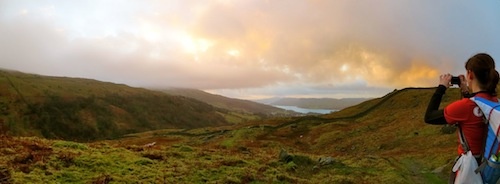
Lovely view back towards Ambleside during the first few km
Inevitably it wasn’t long before we’d hiked right up into the clouds and our gorgeous views had all but disappeared. A brief stop was made to layer up – windproof shells and backpack covers proving the most important items for managing the wet and blustery January chill. When we started to find small patches of snow heaped up along the wall base we knew things weren’t likely to turn much nicer that day (though the Canadian in me was ecstatic to finally see some evidence of proper winter in all this British wet).
The first portion of our hike followed an ancient stone wall, and while the pathway was quite wet in parts at least it was obvious—plus my Gore-tex shoes had good opportunity to prove their worth. As we neared our turnoff away from the wall dozens of pathways criss-crossed the hill and it became difficult to distinguish goat routes and old river beds from actual paths in the mounting fog. We walked a few hundred meters past our turnoff before noting the mistake, and a quick huddle behind the protective shelter of the wall gave a much needed opportunity to don mitts and toques, re-check the map and get back on track. On a more featureless landscape the poor visibility might have been cause for concern, but thankfully the path when found followed along an old fence line, giving a good bearing for staying on trail (or retracing our footsteps if we had turned out to be wrong!)
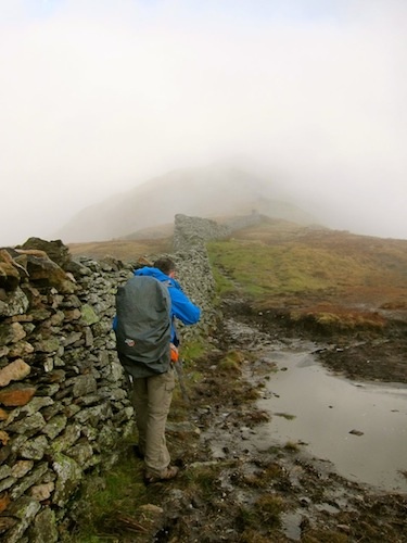
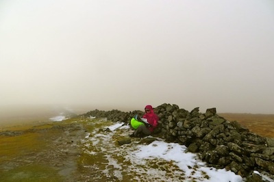
Getting colder... and foggier! Time to layer up and double check the map
We pushed on up to the highest point of our hike, where the wet conditions had led to frozen pathways that required some careful stepping. Reaching the summit didn’t bring any views, but did reveal an old surveyor’s trig point, which turned out to have been used by Rick’s father when mapping the Lake District back in the 70s.
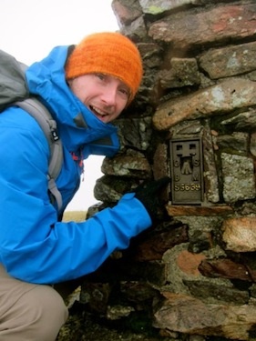
Trig point!
The Red Screes proved the most hazard part of the hike, dropping over 200 meters down worn, rock-cut steps on the hillside. The icy conditions gave us some pause here as well, but cautious footing got us down without much trouble, and part way down the slope the clouds cleared just enough to show us our oasis at the hill’s base: the Kirkstone Pass Inn!
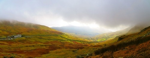
First view of the pub - down across the valley from the Screes
This old pub was has been around for over 500 years, and sits at a height of 454 meters (the highest in Cumbria). A 20 minute break by the warm fire gave us a chance to thaw out and down a much anticipated pint, and though we may have looked somewhat scruffy the locals seemed quite used to the ways of smelly hill walkers. The short regroup was followed by a last easy 5 kilometers downhill back to town, where a greatly anticipated dinner was calling.
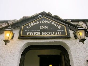
Older than Canada...by quite a bit!
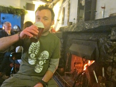
Ahh... a well earned bit of refreshment and a roaring fire
Trip Length: ~18 kilometers with 1050 meters ascent (6.5-7.5 hours, plus obligatory pub break)
How to get there: From Ambleside follow Nook Lane out of town until you come to Nook Farm. Head through the gate and up the path past Low Sweden Bridge.
Gear List
On my Back
- Smartwool medium PhD socks

- Salomon Ellipse Mid Goretex Boots
- IoBio lightweight merino tights
- The North Face Horizon Tempest pants
- Smartwool Midweight Zip Neck
- Patagonia Triolet Jacket
- Deuter Compact EXP 12 with rain cover

In my Bag
- Topo map of route ("Handi Hikes Map #10: Walk the Fairfield Horseshoe")
- Nalgene 32 oz. Wide Mouth Canteen (x2, full)
- Steripen AdventurerOpti

- Granola bars, peperoni sticks, chocolate, candy
- The North Face Jackson Hybrid Jacket
- North Face Redpoint Mitts
- Toque
- Extra pair of Smartwool socks
- Toilet paper
- Plastic bag for garbage
- Duct tape
- First Aid Kit
- Emergency cell phone
- Headlamp
- Camera (in waterproof Pelican 1010 case)

